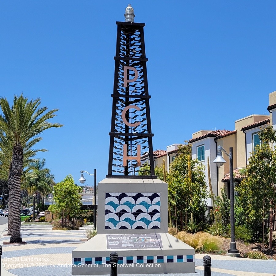
PCH Monument
The southern terminus of California State Route 1 is where the highway intersects Interstate 5 in Dana Point. The tower of the monument is an homage to a 125-foot tall Richfield Oil tower that stood beside PCH about a block away from 1928 to 1971. Originally part of the Roosevelt Highway, the California State Legislature designated the segment between Dana Point and US 101 near Oxnard as the Pacific Coast Highway (commonly referred to as “PCH”) in 1941. At a total of just over 656 miles (1,056 km), CA-1 is the longest state route in California. The highway is designated as an All-American Road by the U.S. Dept. of Transportation and a Blue Star Memorial Highway in tribute to the U.S. armed forces.
Dana Point, Orange County
Images by Andrew Schmidt
